In a hidden corner of central Asia, surrounded by two mountain ranges and four countries, lies the Wakhan Valley. Once upon a time, Marco Polo traversed this valley; today, not even the Taliban make it here...
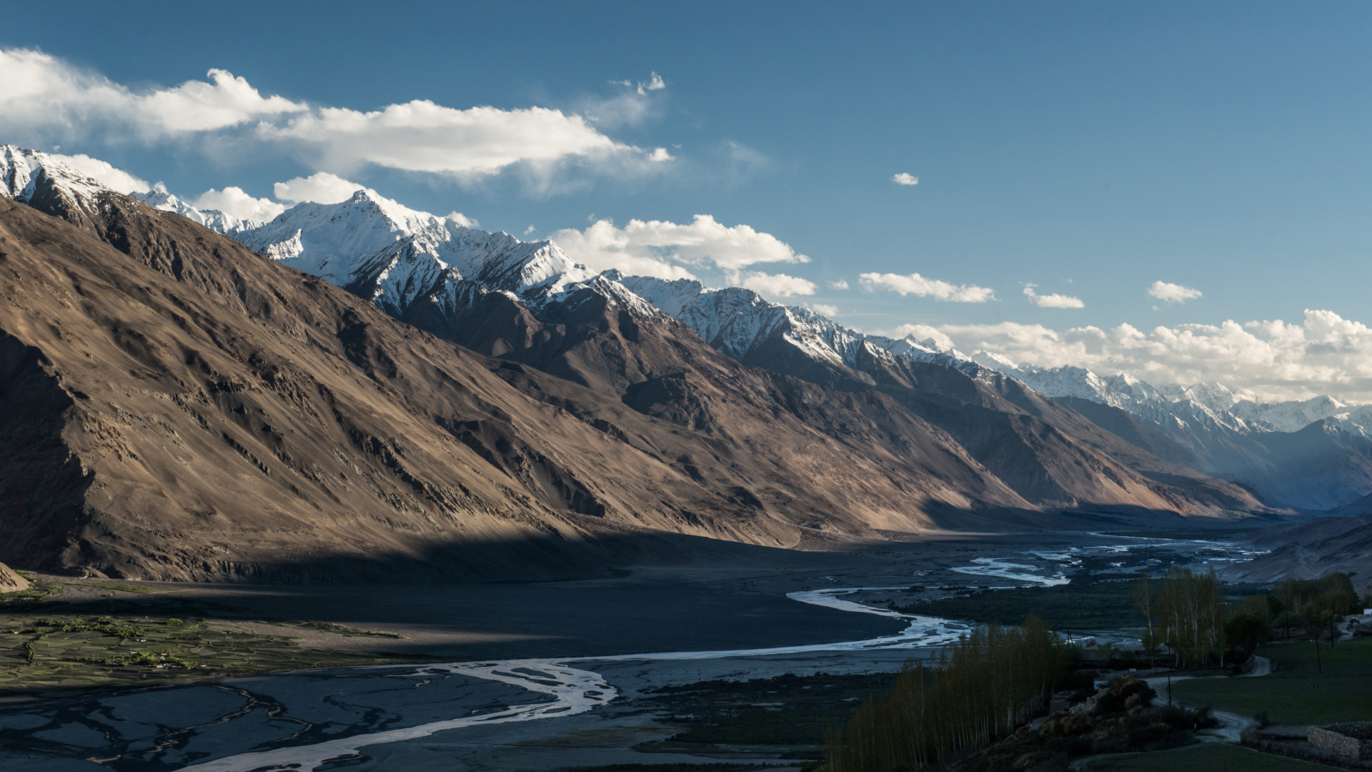
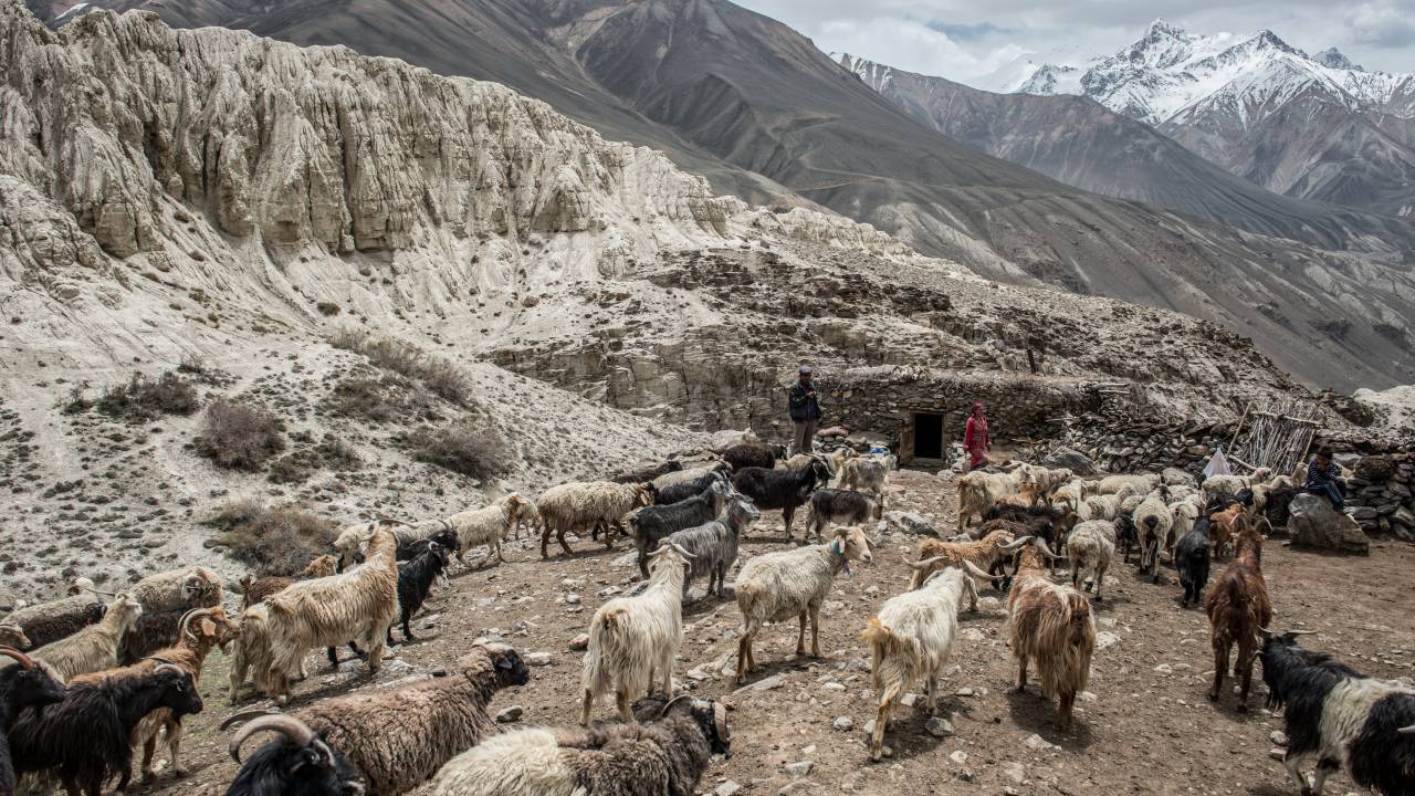
Less than a dozen kilometres separate the two rows of mountains, yet they are in two different countries. The Panj – an icy river in the centre of the valley – marks the border between the central Asian states of Afghanistan and Tajikistan. The water meanders through the elevated valley over flat expanses, fed by two mountain rivers. This is where the inhabitants of the valley bring their sheep and goats to drink. It is not until many kilometres further westward, after leaving behind the towering mountains, that the Panj swells into the Amu Darya. We approach from the Tajik side. In the last of the bigger towns, we find a driver who brings us into the Wakhan Valley. From here, we’ll be returning by foot. We have to be back in the provincial city of Ishkashim in a week.
The majestic scale of the two mountain ranges and the lack of points of comparison make it difficult to estimate distances. If you squint on one side of the valley, you can make out little paths on the opposite side of the mountain. Herds of cattle drifting across the slopes look like strings of pearls. Behind them, in good weather, furrowed valleys reveal glimpses of white glaciers towering into the sky.
In our era, a great deal has been made possible by technology; flights to another continent have been a casual component of the everyday lives of lots of people for a long time. But there are still places on Earth which can’t be reached so simply. The Wakhan Corridor, which comprises the southern part of the Wakhan Valley, is such a region. It’s in northern Afghanistan, where the border abruptly veers off and squeezes itself into the form of a 300km strip of land wedged between Pakistan and Tajikistan – as if Afghanistan were stretching out with all of its might, in order to touch the Chinese border for just a few kilometres.
The country’s eccentric detour toward the east has historical and political causes. The Wakhan Corridor was set up in the nineteenth century as a geographical buffer between the Russian and British spheres of influence, the competing superpowers of the Great Game. If we look at a topographical map, it becomes clear why even today that swathe of land – between 20 and 60 kilometres in width – forms an isolated zone into which not even the Taliban has been able to penetrate. The valley is located between 3,000m and 5,000m of altitude, ragged mountains dominate the landscape and all the larger Afghan cities are hundreds of kilometres away. Less than 15,000 people live on the Afghan side of the valley, in a region the size of Lebanon.
The last official border crossing to Tajikistan before the beginning of the corridor is an unspectacular bridge which connects the two sides of the border, both of which share the name Ishkashim. On Saturday, a market is held on a small island in the river, and people from both sides of the Panj proffer their wares – fruit and vegetables, meat, fabrics, rugs and souvenirs.
After Ishkashim, on the Afghan side the road only continues a few more kilometres eastward, quickly turning into little trails which hug the slopes of the 7,000m mountains of the Hindu Kush. Once upon a time a trade route ran along the Wakhan Valley through to China; supposedly, Marco Polo himself travelled this route. But for a century the eastward corridor has been a dead end, the border crossing to China sealed up.
On the Tajik side, the infrastructure is somewhat more developed. Small villages form green oases amongst the grey mountains. With every passing year, a few more outdoor tourists appear. On foot, by bike or in cars, with hiking maps, tents and bright camping jackets. A road runs alongside the Panj, sealed in places and nothing but loose gravel in others. Beside the road run lengths of electricity cables and trenches; at some points there are even traffic signs. After half a day in the car a bigger road appears, which leads north towards Kyrgyzstan.
But we get out in the village of Langar and begin our hike back towards Ishkashim. The Panj is not particularly wide here. Apart from an abandoned border post, there are hardly any signs of border surveillance. The river seems puzzlingly untouched. There are no boats to be seen. It is as if the Wakhis – as the inhabitants of the region are known – have been held apart by an invisible hand, rather than just drifting apart over time. “It feels as if I’ve travelled through three centuries on this trip,” says young Dane Zara, who has spent a few weeks on the Afghan side of the Wakhan Corridor and is now following the road on the Tajik side. Something as simple as children attending school was not at all taken for granted on the Afghan side of the Panj.
Two villages later, we relax near the river under a couple of trees. A bunch of kids show up with a ball and hesitate for just a moment before asking us to play with them. Boys and girls alike play boisterously, and the smallest is sent off to collect stray balls.
The people from the eastern mountains of Tajikistan identify themselves as Pamiris. They speak Pamiri, and as residents of an autonomous province they are set apart from the western part of Tajikistan. As followers of Isma’ilism, they form a separate branch of Shia Islam. Their spiritual leader is Aga Khan, whose foundation also funds the majority of the development projects in the Pamiri mountains. A photo of the religious leader hangs in many houses above the tapchan, a platform lined with brightly coloured cushions and exquisitely embroidered rugs where families sleep at night and guests can be entertained during the day.
The Pamiris we encounter all display an opulent form of hospitality: on the path between the villages Zong, Shirgin and Vrang, people of all ages continually invite us into their homes. As soon as we enter, the tapchan is covered with tea, bread, shirchoi (salty white tea), nuts and sweets, followed by fried potatoes, noodles or buckwheat. Even in the few little stores where we just want to buy water, we are invited inside for tea. “Our grandparents taught us to keep our house and our heart open for everyone. We teach our children that as well,” says the owner of the store.
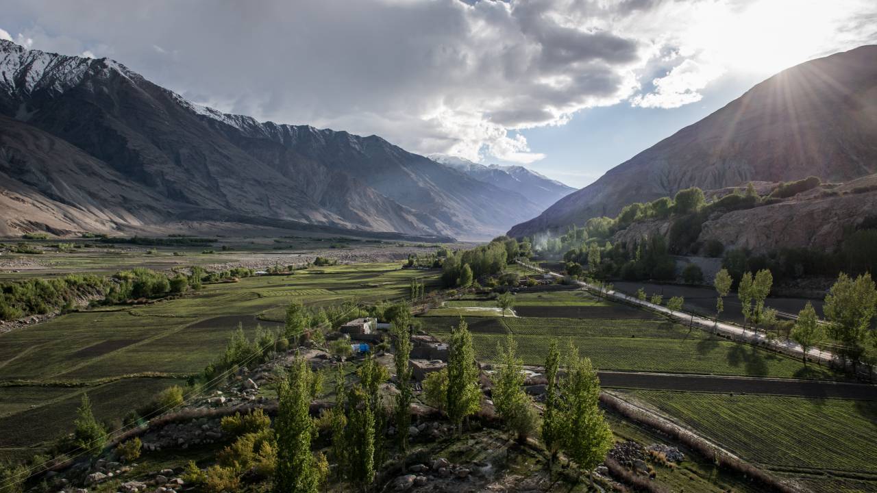
In order to make some headway, we leave the road and seek out a path above the villages. From this vantage point, we have a majestic view over the valley. Little fields and cultivated groves paint green rings around the towns. Between them, grey and brown tones predominate. After a few hours, we come across a group of men returning from a hot spring where they have been bathing. Since the day has already begun to slowly draw to a close, one of them insists on putting us up for the night. Kolya lives with his wife and three children in the upper part of the village of Shirgin. Behind his house the landscape inclines steeply, straight up the mountain. Out front there are a few small fields. Stone walls and moats run between the parcels of land. In his house, Kolya has a small shop in which he sells clothing and other basic items from Khorog and the capital Dushanbe. Down on the road, where there is more traffic, he wants to build a guesthouse. He is trying to save money to pay the equivalent of $3,000 dollars for his son to train as a police officer in the capital.
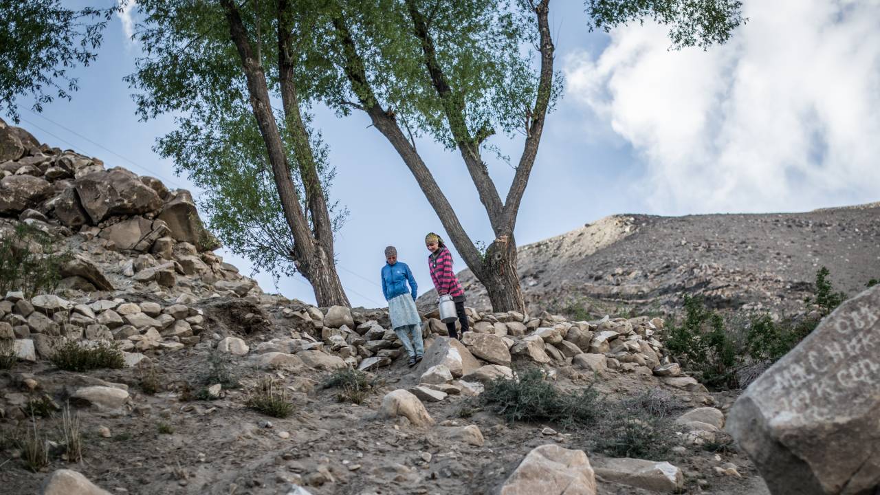
Kolya’s family gets by through subsistence farming, like most people in the Wakhan Valley. Many families keep sheep and goats, which provide milk and meat. The most precious resource here is the water flowing into the valley from all directions. A sophisticated irrigation system gives the villages the appearance of green oases in the grey mountain landscape. Poplars and bushes provide protection from the sun and wind, green meadows nourish the livestock. Usually the whole family is involved in the work in the field and with the livestock. There is little waged labour in the Wakhan Valley. A large part of the income comes from Russia, as there is hardly a family in Tajikistan that has not sent a male family member to Russia or elsewhere as a guest worker.
On the final day of the walk, we climb a few hundred metres higher one last time, to visit the mineral spring Bibi Fatima. It is mostly Tajik tourists who travel here to bathe, in a simple cement building built directly into the wall of the cliff. In alternating shifts, men and women plunge into the clear, hot water which flows directly into a pool from a cave deep within the mountain. The bath is good for your health, the people say. Our exhausted legs, which feel as if they have reached the end of the world, are only too happy to believe it.
This article was originally published in German in the 3/2015 edition of zenith.
